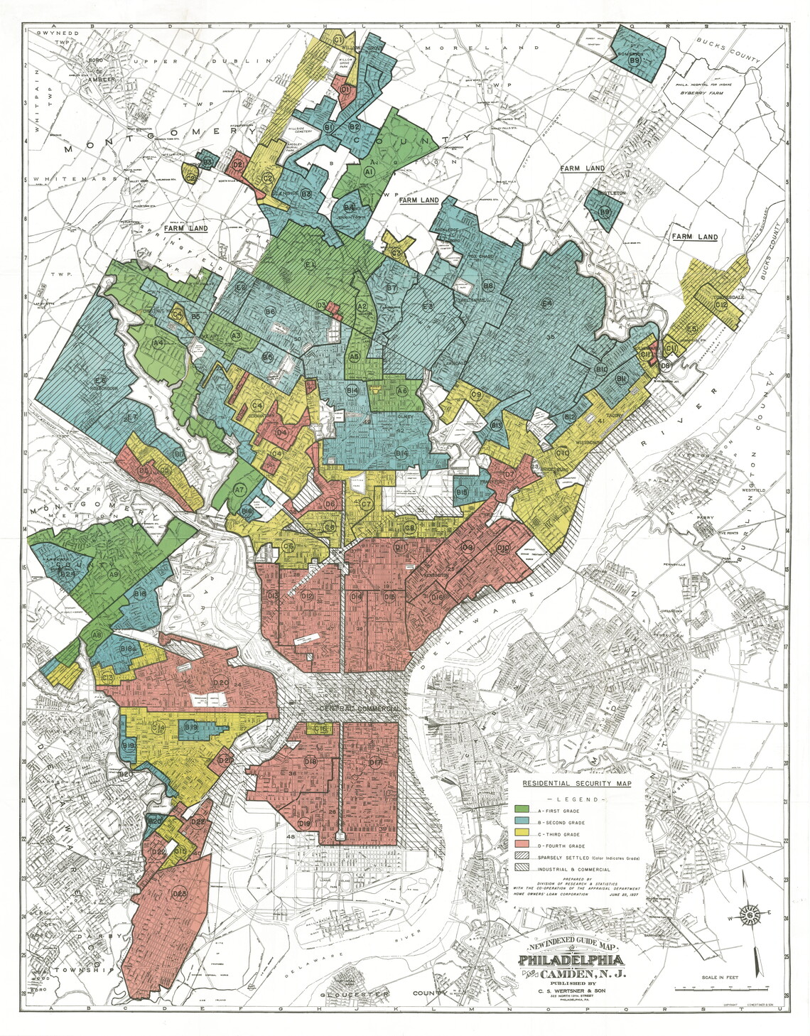
Source: Home Owners’ Loan Corporation map entitled “Residential Security Map” on a base map from New Indexed Guide Map of Philadelphia and Camden, N.J.,” Philadelphia: C. S. Wertsner & Son, n.d. (City Survey Files, 1935-1940, National Archives, courtesy of Mapping Inequality, Digital Scholarship Lab, University of Richmond)
The red sections for fourth-grade, or “hazardous,” gave the term “redlining” its name.