1820, 1823
Melish, John, fl. 1820-1823
Map
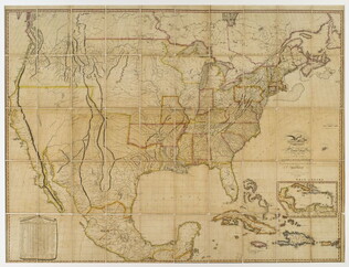
Title: A Map of the United States with the contiguous British & Spanish possessions
The 1823 edition, but copyright 1820. Of Melish and his maps, Martin & Martin write (p. 115): "Recognizing the demand for geographical information on the American West was limitless for the foreseeable future, Melish undertook to accumulate a vast amount of descriptions, statistics, and maps, and in 1816 produced in six sheets his famous map. It proved so popular it was reprinted at least twenty-two times by the end of 1822. For the Texas area, Melish relied heavily on the surveys conducted by William Darby, who had personally surveyed much of the Sabine River area.... Melish's map…
GLC04319
