The Gettysburg College–Gilder Lehrman MA in American History: Apply now and join us for Fall 2024 courses
circa 1864
Goss, Warren, fl. 1864-1880
Map of the prison
Map of the prison, with the locations of photographs # 1, 2, 4, 5, 6, 7 marked.
GLC06999.36
Map of the prison and surrounding areas.
GLC06999.37
1862
Abbot, Henry Larcom, 1831-1927
Campaign Maps Army of the Potomac, Map No. 1. Yorktown to Williamsburg [Manuscript map signed]
Title continues: "Prepared by Command of Maj. Gen. George B. Mc.Clellan U.S.A. Commd'g Army of the Potomac A.A. Humphreys Brig. Gen. and Chief of Top. Engr's." Accomplished on four pieces on joined wove paper. Photographed at the Coast Survey Office...
GLC04355.02
Campaign Maps Army of the Potomac, Map No. 1. Yorktown to Williamsburg
Title continues: "Prepared by Command of Maj. Gen. George B. Mc.Clellan U.S.A. Commanding Army of the Potomac Brig. Gen. A.A. Humphreys Chief of Top. Engrs Army of the Potomac." Engraved by W.H. Dougal. Map compiled by Abbot. Printed version of...
GLC04355.03
GLC04355.04
Campaign Map Army of the Potomac, Map No. 3. White House to Harrisons Landing
Title continues: "Prepared by Command of Maj. Gen. George B. Mc.Clellan U.S.A. Commd'g Army of the Potomac A.A. Humphreys Brig. Gen. and Chief of Top. Engr's." Map compiled by Abbot. Photographed at the Coast Survey Office. A very faint brown-line...
GLC04355.05
"Prepared by Command of Maj. Gen. George B. Mc.Clellan U.S.A. Commanding Army of the Potomac Brig. Gen. A.A. Humphreys Chief of Top. Engrs Army of the Potomac." Print engraved by W.H. Dougal. Map compiled by Abbot.
GLC04355.06
Campaign Maps Army of the Potomac, Map No. 2. Williamsburg to White House
Title continues: "Prepared by Command of Maj. Gen. George B. Mc.Clellan U.S.A. Commd'g Army of the Potomac A.A. Humphreys Brig. Gen. and Chief of Top. Engr's. Photographed at the Coast Survey Office. A faint brown-line print on four pieces of joined...
GLC04355.07
GLC04355.08
circa December 1862
Bush, George, fl. 1862
[Map of Fredericksburg]
A fairly complete and accurate map of the Union position at Fredericksburg. Shows federal positions, pontoon bridges, geographic features, roads and houses used as hospitals. The position held by Gibbon's Division is slightly exaggerated.
GLC03607.08
20 March 1862
Worret, Charles, 1819-?
[Manuscript map, Military Reconnaissance Dept. Va]
Title continues: "Major Genl. Wool Comdg. Drawn by Sergt. Worret & Compiled Under the Direction of Colonel T.J. Cram Chief Topl. Engr. Dept. Va." "Copy." Shows the Yorktown Peninsula and contains a description of the area in terms of its potential...
GLC04355.01
circa 1775-1776
[Battle plan for the siege of Boston Harbor]
Mapped battle plan for an American siege of Boston Harbor. Shows boats and some major geographic markers. For written plans see GLC02437.00231.
GLC02437.00232
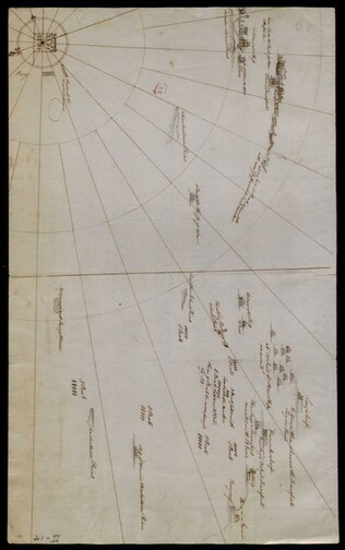
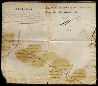
1795
Gleason, John, fl. 1796-1811
[Map of land]
Map of surveyed land possibly located in Maine. Titled, "THE SOUTH LINE OF the 50000 Acres Run By John Gleason Junr 1795 No 1." Covers three miles and a half of land and includes notes on the quality of land. Document is partially printed with...
GLC02437.10598
circa 1585-1763
Lincoln & Edmands
Book of maps
The maps include the world, Asia, Europe, Africa, North America, South America, and New England States.
GLC03107.05320
February 1864
Jones, Joseph, fl. 1862-1865
[Fort of Sweetwater, Tennessee]
GLC02739.101
circa January 1863
[Map of fortifications]
GLC02739.159
Showing results 251 - 266