Self-Paced Courses: Explore American history with top historians at your own time and pace!
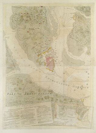
1780
Barres, Joseph Frederick Wallet des (1722-1824)
A Sketch of the operations before Charlestown [Charleston, S.C.]....
The key provides detailed military information. Nebenzahl, Battle Plans of the American Revolution, 136.
GLC03103.13
A Sketch of the battle near Camden in South Carolina, August 16, 1780
Nebenzahl, Battle Plans of the American Revolution, 89, who notes that the order of battle is correct while the terrain appears to be inaccurate.
GLC03103.14
Untitled chart of the coast of Georgia and South Carolina [Savannah]
Includes small plan of the siege of Savannah in a cartouche.
GLC03103.15
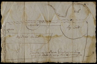
1714/08/18
Unknown
Manuscript map [in Dutch]
Most likely a section of Livingston's Manor, as Roeloff Jansen's Kill runs through the middle of it. Docket reads: Jurian Deckers Folly.
GLC03107.01088
1957
Smith, Karl, (fl. 1938-1959)
A Map of the United States 1492-1783
One map illustrated by Karl Smith and published by Linweave Quality Papers, and Chicago Paper Company in 1957. The map features the United States as it was from 1492-1783. It includes the borders of the new states at the close of the American...
GLC09861.01
1958
A Map of the United States 1784-1844
One map illustrated by Karl Smith and published by Linweave Quality Papers, and Chicago Paper Company in 1958. The map features the United States as it was from 1784-1844. It includes the borders after the Louisiana Purchase in green. In yellow is...
GLC09861.02
1959
A Map of the United States 1845-1866
One map illustrated by Karl Smith and published by Linweave Quality Papers, and Chicago Paper Company in 1959. The map features the United States as it was from 1845-1866. It includes the borders after the Civil War outlined in green. Shaded in green...
GLC09861.03
A Map of the United States 1867-1960
One map illustrated by Karl Smith and published by Linweave Quality Papers, and Chicago Paper Company in 1959. The map features the United States as it was from 1867-1960. It includes the borders of the United States in 1960. Shaded in green are the...
GLC09861.04
1935
P.W.A. in Action
One map entitled, "P.W.A. in Action," dated 1935. Map consists of an illustration of the United States; including each of 50 states identified by a local Public Works program. Programs mentioned are related to housing, transportation, defense, museum...
GLC09879
1749
Schreibern, J.G. (fl. 1749)
Africa
One map entitled Africa, dated 1749. Contains the entire continent of Africa, as well as a small portion of the Middle East. The island of Madagascar is also included. The map and key are in German. Some sections are shaded indicating different...
GLC09862.01
Showing results 171 - 180