Meet the 2024 History Teachers of the Year!
1794/05/14
Whittle, & Laurie, fl. 1759
A new and general map of the middle dominion belonging to the United States...
The map shows part of the United States, from western New England to Michigan, and from Vermont to southern Virginia.
GLC04178
1786/08/15
Sayer, Robert, 1725-1794
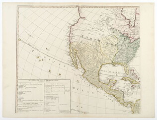
A Map of the Whole Continent of America... [Wall Map on 4 sheets]
GLC04412.01
1787/01/01
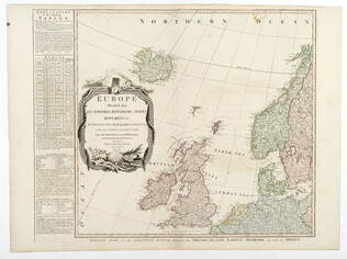
Europe divided into its Empires, Kingdoms, States... [Wall Map on 4 sheets]
This map has an attractive depiction of Algiers and the Barbery states which is slightly larger than that for GLC# 4412.04 (Africa)
GLC04412.02
1787/01/06
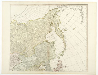
Asia and its islands, according to D'Anville... [Wall Map on 4 sheets]
GLC04412.03
Africa with all its states, kingdoms... by S. Boulton [Wall Map on 4 sheets]
GLC04412.04
Showing results 6 - 10