The Gettysburg College–Gilder Lehrman MA in American History: Apply now and join us for Fall 2024 courses
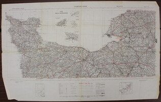
1941
War Office
[Map of French coast from Cherbourg to Rouen]
A first edition European road map published by the War Office in 1941, showing the French coast from Cherbourg to Rouen.
GLC09557.01
March 1944
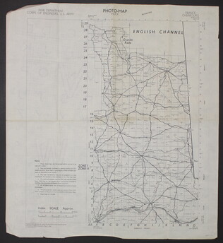
War Department Corps of Engineers, U.S. Army
[Photo-map index]
A two-sided photo-map index of the English Channel. One side of the map shows Cherbourg, France, the English Channel, and Grande Rade. There is a grid over the map labled 1 to 29 on the y-axis and A to O on the x-axis. The reverse side of the map...
GLC09557.02
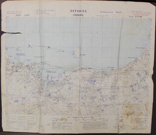
May 1944
Defenses Cherbourg
A two-sided map of the defenses of Cherbourg, France. The shows the map itself, while the back has a large legend. There is a tear in the upper left quadrant of the map.
GLC09557.03
U.S. Army
Defences Lessay
A two-sided map of the defences of Lessay, France. The front shows the map itself, while the back has a large ledgend.
GLC09557.04
1943
Port en Bessin to Cherbourg [and] Entretat to Port Bessin
A two-sided map of the coastline of France. One side of the map shows the Port en Bessin to Cherbourg and the reverse side shows Entretat to Port Bessin. This map has three hole punches and is labled page 185 and 186, but the rest of the book or...
GLC09557.05
ca. 1944
[Allied invasion of Normandy sectors]
A map of the five areas where Allied troops invaded Normandy on June 6, 1944.
GLC09557.06
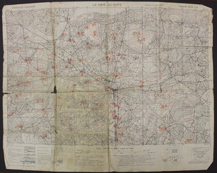
September 1943
La Haye du Puits [French]
A map of La Haye-du-Puits, France. There are numbers handwritten in orange on the map, but it is unclear what they represent. The back of the map has "La Haye Du Puits 31/18 S.W.," written in red.
GLC09557.07
January 1945
United States. Naval Oceanographic Office
France - North Coast: Asnelle to Villers Including Caven Roadstead
A greyscale map of the North coast of France. Originally produced by the French government in 1893 with updates made in 1928, 1930, 1931, 1932, 1934, 1937, and 1938.
GLC09557.09
1860
Map of Georgetown and the City of Washington
GLC09118.53
1891
Map of Antietam
Goes with item GLC02198.38. Includes line of advance.
GLC02198.39
Showing results 141 - 150