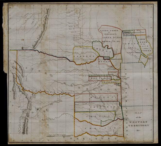
United States. Congress Map of the Western Territory & c.
Order a pdf of this item here.
A high-resolution version of this object is available for registered users. LOG IN
Gilder Lehrman Collection #: GLC04132.02 Author/Creator: United States. Congress Place Written: Washington, District of Columbia Type: Map Date: 20 May 1834 Pagination: 1 map Height: 44.3 cm, Width: 48.4 cm Order a Copy
Large folding map of present-day Oklahoma with borders outlined in watercolour designating areas occupied by Native American tribes. Map was previously bound in back of the House Report found in 4132.01. Border lines are colored in blue, yellow, orange, green, and pink.
Citation Guidelines for Online Resources
The copyright law of the United States (title 17, United States Code) governs the making of photocopies or other reproductions of copyrighted material. Under certain conditions specified in the law, libraries and archives are authorized to furnish a photocopy or other reproduction. One of these specific conditions is that the photocopy or reproduction is not to be “used for any purpose other than private study, scholarship, or research.” If a user makes a request for, or later uses, a photocopy or reproduction for purposes in excess of “fair use,” that user may be liable for copyright infringement. This institution reserves the right to refuse to accept a copying order if, in its judgment, fulfillment of the order would involve violation of copyright law.
