1755
Le Rouge, George L., fl. 1755
Map
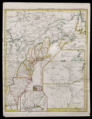
Title: Canada et Louisiane [double page engraving with handcoloring]
Drawn by George Le Rouge, Engineer to the King. With hand-colored outlines. Double-page engraving showing the east coast of North America from New Foundland to Florida, with insets of Niagara Falls (small), New Orleans (medium) and upper Louisiana (large). The border of the English colonies clearly runs along the Alleghenies. Forts are also indicated, including Washington's Fort Necessity.
GLC05714
